





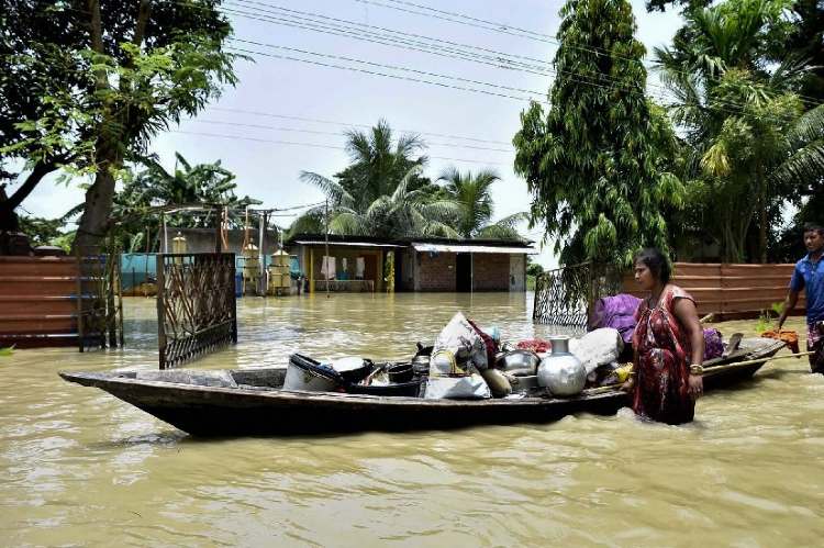
Assam floods preparedness under lens: Assam has always had to live with floods. The Brahmaputra and its tributaries carry enormous quantities of sediment down from the Himalayas, constantly shifting channels and sandbars across the Assam Valley. Flooding during the monsoon is therefore part of the state’s physical geography. The harder question is why a familiar hazard continues to cause such heavy damage to homes, farms, infrastructure and livelihoods.
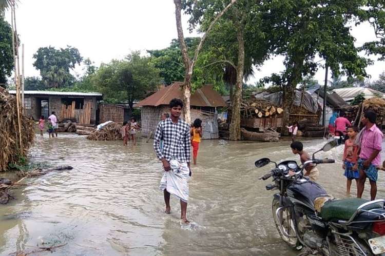
The Assam floods of 2026 brought that question into sharp focus. From late June to early August, several spells of heavy rain produced repeated flooding in Upper Assam and neighbouring hill catchments. More than 500,000 people were affected across the wider region and over 45,000 hectares of cropland were submerged, according to World Weather Attribution. At least 99 deaths had been reported in Assam floods when its assessment was published in August.
It is tempting to put the blame on climate change. The evidence from this particular episode is less straightforward. World Weather Attribution found no clear trend in the available rainfall data and estimated that the three-day and 30-day rainfall events had return periods of less than two years. Its analysis found that human-induced warming had not materially changed the likelihood or intensity of this year’s heavy rainfall, although the researchers stressed that the evidence is uncertain because rainfall observations in the region are sparse.
That does not make climate change irrelevant. It does make the policy question more immediate. Assam cannot control the monsoon, and it certainly cannot control the Brahmaputra. It can influence how much damage a familiar flood causes.
READ I Himalayan floods, climate crisis and the need for disaster diplomacy
Assam floods also a land-use problem
The physical hazard is only part of the story. World Weather Attribution’s review of 35 studies points to unplanned urbanisation, deforestation, poor drainage and inadequate flood-management structures as important factors increasing exposure and damage. Wetland degradation and changes in natural drainage can leave less room for water to spread without causing economic disruption.
Assam’s own disaster-management plan makes a similar point about urban areas. It identifies rapid and unplanned urbanisation, population growth and changes in land use as factors that have damaged urban ecology and increased vulnerability.
This matters because Assam floods policy can otherwise become a contest for more embankments, higher walls and larger engineering works. Such investments are sometimes necessary. But an embankment protects one area while potentially altering water flows elsewhere. If drainage is blocked, sediment accumulates or a structure fails, the protection can become part of the problem.
The answer is not to abandon embankments. It is to stop treating them as a complete flood-control strategy. Assam needs to decide where structural protection offers a reasonable return and where land-use controls, drainage improvements, wetland protection and floodplain management make more sense.
READ I Heatwaves and floods expose India’s urban policy gaps
Economic loss begins when the water rises
For a salaried government employee, a flood may mean a difficult commute. For a daily-wage worker, it can mean a week without income. For a small farmer, it can mean the loss of a crop, livestock and several months of working capital. For a street vendor or small shopkeeper, damaged stock can turn a temporary disruption into a debt problem.
This distinction is important in assessing disaster policy. The number of people rescued or housed in relief camps is an essential measure of emergency response, but it says little about the speed of economic recovery.
Assam floods show how persistent the burden is. The state has experienced major floods repeatedly, with substantial damage to agriculture, infrastructure and livelihoods. The Water Resources Department says the average annual area affected by floods is about 9.31 lakh hectares.
Repeated losses can also alter household behaviour. Families may reduce investment in homes or productive assets in areas where destruction is expected. Children may lose schooling when families migrate temporarily. Workers may move elsewhere in search of employment. A disaster that occurs every year or two can therefore become a slow-moving development problem.
That is why relief expenditure should not be judged only by how quickly money is distributed. The more useful question is whether public spending reduces the cost of the next flood.
READ I Floods, diarrhoea and India’s child malnutrition crisis
Early warning must lead to early action
Assam is not starting from zero. The Assam State Disaster Management Authority has systems for weather alerts, emergency response, search and rescue and relief management. Its 2026 guidelines also include procedures for restoring damaged schools and Anganwadi centres. The authority has issued repeated heavy-rainfall advisories during 2026, including warnings in June, July and August.
The problem is therefore less one of inventing institutions than of making them work further upstream.
A useful warning should trigger decisions before a village is cut off. Relief materials should be positioned in advance. Vulnerable households should be identified before evacuation becomes urgent. Health facilities need contingency plans for periods when roads and communications fail. Farmers and other workers who lose productive assets need a mechanism for restarting economic activity, rather than simply surviving the immediate emergency.
The World Weather Attribution assessment notes that some districts had already begun taking anticipatory measures, including vulnerability assessments and the pre-positioning of flood-fighting materials in Sivasagar. The opportunity is to extend such practices across districts rather than treat them as isolated initiatives.
There is also a case for better information. A flood-prone state needs district-level maps showing where homes, schools, health centres, roads, farms and informal settlements face the greatest risk. Such maps should guide public investment and land-use decisions, not merely be produced for disaster reports.
From flood relief to flood economics
The central policy mistake would be to frame Assam’s problem as a choice between engineering and nature, or between development and environmental protection. The real issue is how scarce public money can reduce losses in a state where flooding will remain a fact of life.
Some embankments will be worth strengthening. Some settlements will require better drainage and flood-proof infrastructure. Some wetlands should be protected precisely because they provide inexpensive flood storage. In other locations, repeated public expenditure on rebuilding the same assets may make less economic sense than relocating them.
This requires a shift in the way flood damage is calculated. The cost of a flood is not simply the value of roads, bridges, houses and crops destroyed. It includes lost working days, interrupted schooling, disrupted healthcare and the capital that poor households have to spend to rebuild what they had already built once.
Assam cannot prevent the Brahmaputra from flooding. It can, however, reduce the amount of economic capital that each flood destroys.
That is the more useful definition of resilience. The success of a policy on Assam floods should ultimately be measured not by the size of the relief package announced after the waters rise, but by the losses that no longer occur when they do.
Dr Yatish Kumar is Assistant Professor at the Indian Social Institute, New Delhi, India.