


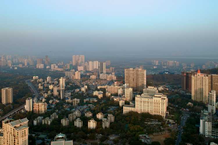
India needs digital infrastructure: India’s most successful digital systems run on common rails. Aadhaar established identity, UPI reorganised retail payments, DigiLocker made official documents portable, and GSTN connected a fragmented indirect-tax system. Land and construction remain outside this architecture. Records conflict, drawings sit in separate files, and municipal approval systems rarely exchange information with utilities or planning agencies.
Land records may not match planning maps. Municipalities, utilities and infrastructure agencies maintain separate datasets. Lenders rely on manual valuations and documents that are difficult to verify. Environmental information often enters after a project’s location and layout have been decided.
The costs appear as delayed approvals, design changes, litigation, weak enforcement and lending against incorrectly valued assets.
READ | Delhi urban heat island exposes planning neglect
Environment digital public infrastructure
India needs a federated digital public infrastructure for the built environment. Each institution should retain control of its records while making verified information available through common standards and secure interfaces. Seven capabilities would form its core.
1. Construction information
Building models, approved drawings, compliance records, revisions and digital signatures should be held as structured data rather than scattered files.
Architects, structural engineers, fire departments and building-services consultants could then work from the same approved record. Software could check floor-area ratios, accessibility rules, energy standards and fire codes before an application reaches a municipal officer.
Professional judgement would remain with architects, engineers and officials. Digital checks would remove repetitive work and record who approved a change, when it was approved and under which rule.
2. Land and legal records
Ownership records, cadastral boundaries, mutation histories, encumbrances, zoning controls and registration data need to be connected.
The Digital India Land Records Modernisation Programme has computerised large parts of the record system. Yet a digitised revenue map can still conflict with a municipal zoning layer or a sub-registrar’s entry.
Every record should carry its source, legal status and revision history. Courts, planning authorities, lenders and buyers could then establish which record governs a parcel and how it has changed. The proposed system would not settle title disputes. It would make discrepancies visible before land is bought, financed or developed.
The 14-digit Unique Land Parcel Identification Number offers a possible identifier for linking these records.
Built environment data for infrastructure and climate risk
3. Infrastructure digital twins
Roads, railways, metros, utilities, ports and logistics corridors should be mapped as connected systems.
Projects are often delayed by an unrecorded utility, an incorrect right-of-way or a design revision that has not reached another agency. Digital twins can expose these conflicts before construction begins. Agencies could also test alignment, phasing and maintenance requirements against the wider network.
Linking such models with PM Gati Shakti and project-monitoring systems would allow ministries and states to coordinate work along the same corridor.
4. Environmental and geospatial records
Planning systems should bring together terrain, hydrology, floodplains, rainfall, land use, soil conditions, heat and coastal risk.
Municipalities and infrastructure agencies could test a proposal against flood paths, watersheds, slopes and drainage capacity before approving its location. The same records would support environmental clearance and emergency planning.
India already has satellite, geospatial and meteorological data. Local authorities need access to it in formats that can be used in planning and building approvals.
5. Lending and asset risk
Banks and insurers need verified information about the physical asset behind a loan or policy.
A digital asset record could link approved plans, construction status, encumbrances, occupancy certificates, specifications and later alterations. Banks could compare the asset on the ground with the property they had agreed to finance.
This could reduce inflated valuations, duplicate financing and loans against unauthorised construction. Buyers would also gain a clearer record of the property.
Access cannot be unrestricted. Banks, insurers, buyers, municipalities and regulators should see only the records required for their respective functions. Consent and legal safeguards will have to govern personal and commercially sensitive data.
Municipal approvals and disaster resilience
6. Municipal workflows
A building approval passes through planning, fire, utility and inspection departments before the municipality issues a completion or occupancy certificate. Property taxation and asset management follow. These functions often use different software and records.
One municipal workflow should connect application, scrutiny, inspection, approval, completion and post-occupancy changes.
Smaller urban local bodies cannot move immediately to model-based approvals. They can start with standard data formats, digital submissions and workflow tracking. Rule-based checks can follow as staff and systems improve.
This would give applicants a record of pending decisions and identify the official responsible for each stage. Municipalities would gain more dependable property and tax records.
7. Disaster-response information
The National Disaster Management Authority, state agencies and emergency services need a shared view of buildings, infrastructure, population concentrations and access routes.
Built-asset records could support vulnerability assessments, evacuation plans and the identification of critical facilities. Hospitals, schools, bridges, dams, transport hubs and dense urban districts should receive priority.
Emergency teams would then know the condition, use and access points of a building before entering it during a flood, earthquake, fire or industrial accident.
READ | SVAMITVA scheme turns rural land into bankable collateral
Implementing built environment digital infrastructure
The system should remain federated. Union ministries, state governments, municipalities and regulated institutions would continue to hold their data. A national framework should set common identifiers, metadata, exchange formats, access rules and audit requirements.
Implementation should start with a few uses where the gains can be measured: large public projects, building approvals in selected municipalities, mortgage verification and climate-risk planning in vulnerable cities. The pilots should record approval times, design conflicts, disputed records and adoption by officials.
A national mission may follow. Its first task, however, is to assign responsibilities. The Bureau of Indian Standards, Ministry of Electronics and Information Technology, Ministry of Housing and Urban Affairs, Department of Land Resources, Survey of India, financial regulators and National Disaster Management Authority cannot operate as an informal committee. Each must own a defined part of the architecture.
India has built digital rails for people, payments and documents. Land, buildings and infrastructure now need records that can be verified and exchanged across the institutions responsible for them.
Apurva Pathak is an architect, and built-environment and design-governance advisor based in New Zealand.